October 2009 - Be On The Road | Live your Travel Dream!
none

Friday, October 30, 2009

West Sikkim and Pelling – of monasteries, waterfalls, high bridges and treks in the Kangchendzonga range!!

Of days gone by...this April during my solo all India motorcycle journey


After having a great time touring Tsomgo Lake in East Sikkim, Gurudongmar Lake and Yumthang Valley in North Sikkim, I was now bound for West Sikkim and its largest town – Pelling. And, this time I was back on my motorcycle. It took me about 4 and a half hours to cover the 125 kms from Gangtok to reach Pelling. The entire route was dressed in green and offered some great views. On reaching Pelling, I checked into a hotel with a room that offered me great views of Kangchendzonga peak. Post lunch, I left for a famous tourist spot – Singshore bridge, which is located 25 kms from Pelling.

The road to Singshore was in a pretty bad shape and at couple of places there was hardly any surface and as is typical with the rest of Sikkim, this area is also landslide prone. Finally, after an hour long bumpy ride, I was at the Singshore bridge, which is the highest bridge in Sikkim.It is an engineering feat made possible by connecting two hills. Since, the bridge is old and is of historic value, no vehicles are allowed to go on the bridge. Only people are allowed to walk on it. While standing on the bridge, I got spectacular views of the green hillsides, beautiful hillsides and the deep valley below.


Next day, I visited Pemayangtze monastery in the morning. Though this monastery is not the oldest in West Sikkim, it is still the one that is held in the highest regard as this monastery is only meant for ‘ta-sang’ lamas (pure monks). The Pemayangtze monastery draws religious sustenance from the Mindoling monastery in Central Tibet. The Monastery contains numerous antique idols and objects of worship and is filled with wall paintings and sculptures. A stand out feature of the monastery is a seven tiered painted wooden structure on the top floor portraying Guru Rimpoche’s Heavenly Palace ‘Santopalri’ which was completed single-handedly by the late Dungzin Rimpoche in a span of five years. Once I had seen the monastery, I walked to the Rabdentse ruins, which is situated close by. This ex second capital of Sikkim was ravaged and today exists as ruins that is being preserved by the Indian Archaeological Society. The landscape here is striking. The short trek from Pemayangtze to Rabdentse also offers great bird watching opportunities.


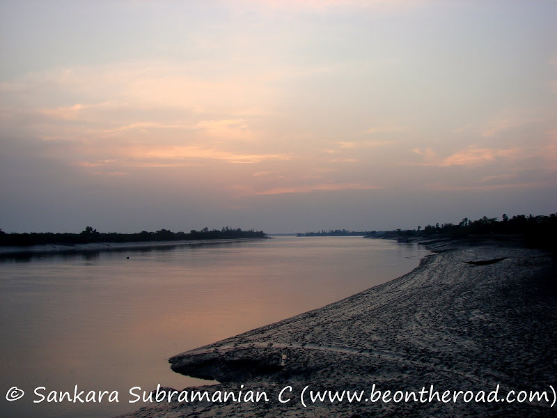
Post lunch, I went to the Khecheopalri lake, which is considered as one of the sacred lakes of Sikkim by the Hindus and Buddhists. The ride to the top of Khecheopalri lake is great, but the lake itself did not generate a lot of interest within me. There is a small temple in one corner and the lake itself looks like a small water body amidst greens. After a short stop here, I next went to the Kangchendzonga falls, which is the largest in West Sikkim. But, when I went there, I found that this area of Sikkim had hardly received any rainfall and  hence the mighty waterfall was a mere trickle.

Overall, a variety trip this was for me in West Sikkim. The stand out feature here is the view of the Himalayan peaks. And at 6,800 feet, Pelling is your lazy and laidback hill station with a lot of sightseeing opportunities. Plus, for the adventure seeker, the town of Yuksom is close by. Apparently, Yuksom is the base camp for all treks in the Kangchendzonga range.

To see India through the eyes of a motorcyclist’s lens, visit the album below.

my solo all-india motorcycle journey

Reblog this post [with Zemanta]

Continue Reading...

Yumthang – Valley of Flowers in North Sikkim, India

Of days gone by...this April during my solo all India motorcycle journey


It was late in the evening and extremely cold by the time we reached the town of Lachung on the eastern end of North Sikkim.

 
It had been an eventful day for us  as we had been through a near death experience and faced a snow storm on our way back from Gurudongmar Lake. All of us shared our respective versions of the experience with the group while our dinner was getting ready. It was only after the hot and sumptuous meal that most of us felt alive. 


After an early morning wake up call, I got ready, had breakfast and waited for the rest of the group. It was during this wait that I admired the beauty of the Lachung valley. I climbed up a small hillock to get a better view of the entire Lachung town, the Lachung Chu (river) and the Himalayan peaks in the background. Soon, the entire group was ready and we got into the jeep and made our climb towards the Yumthang valley.

 
Yumthang is situated 140 kms north of Gangtok, the capital of Sikkim. It is located at an elevation of 11,800 feet (3575 m) with a close proximity to Tibet (China) and is a unique place where the tree line ends. The Yumthang valley, dubbed as the ‘valley of flowers’ is home to the Shingba rhododendron sanctuary. Typically, in the summers, this area blooms with umpteen species of rhododendrons, primulas, poppies, iris and other flora. But, due to unforeseen snowfall over the last one month, the flowering plants were still in deep slumber.

 
The winding route, the snow clad plants, the Himalayan peaks in the distance and the Lachung Chu river were all a treat to the eye. Once we reached the valley, all of us were eager to explore this very pretty valley. Snow balls were hurled at folks, folks were skidding and slipping on the icy floor and most of the group were keeping their cameras busy. Such was the beauty of this place.


There was a mountaineering institute nearby that organizes treks in the summers. But, due to the bad weather, even these guys had closed shop. Finally, after spending a couple of hours at Yumthang, we made our way back to Lachung, had lunch and continued on our long drive back to Gangtok.


Enroute, we stopped at a lovely waterfall that is nicknamed Amitabh Bachchan waterfalls as Amitabh Bachchan shot a movie scene at this exquisite location. We saw more landslides and more bad roads, and finally reached Gangtok late in the evening. The last three days proved to be a phenomenal experience of North Sikkim for me and I hope that the Indian army allows motorcycles to go there someday coz if they do, I would love to tour this part of nature on my motorcycle.

To see India through the eyes of a motorcyclist’s lens, visit the album below.

my solo all-india motorcycle journey

Reblog this post [with Zemanta]

Continue Reading...

Caught in a snow storm while returning from Gurudongmar Lake in North Sikkim, India

Of days gone by...this April during my solo all India motorcycle journey


The weather was getting bad and we were just returning from the Gurudongmar Lake. We stopped at the army camp at Giagong as a couple of folks in our group were struggling with Acute Mountain Sickness (AMS). We took them to the army medic camp where the army doctors put them on oxygen and gave them shots to dilate their lungs and thereby help retain more oxygen. Even our jeep driver seemed to be struggling. Me and a couple others enjoyed a cup of hot coffee with the soldiers while the others were being treated. After spending half an hour here, we were told by the army officers to descend rapidly as the weather was bound to get worse. And all this when we still saw no signs of the other 2 jeeps.


We were worried and provided the details of our other 2 jeeps and their crew. It was only after a short while did we find out that one of the jeeps had lost their way in the desert and bad weather and entered dangerous border territory and were in the custody of the Indian army. It was only after much convincing and a message from the Giagong army camp were they allowed to leave and that to in the company of an army vehicle. By the time our other two jeep joined us, the weather had turned for the worse with heavy snowfall and heavy gusts of wind.


Slowly, but together, we made our descent to the army base camp at Thangu. The visibility was getting poorer and a thick sheet of snow was covering our windshields. And to make matters worse, the windshield wiper in my jeep stopped working. Our driver would stop every 5 minutes and clean the windshield with a piece of cloth to remove the thick crust of ice that had formed on top of the windshield. Shortly, all vehicles stopped. We wondered what the problem was and soon found out that an army truck in front of us had some problems. After completely covering myself, I got down to get specifics.


Only when I went close to the army truck, did I figure out that their diesel fuel tank had frozen. One soldier was trying to warm up the fuel tank by lighting a fire under it. The others were trying to clean the oil filter and other parts that were frozen. It seemed like a never ending wait. The army jawans kept on trying, but the vehicle didn’t fire at all. Meanwhile, one of our jeeps stopped running and we found out that its oil filter was also frozen. Seeing this, the others kept revving the engine in a bid to keep it nice and warm. Soon, the jeep with the frozen oil filter was fixed, but the army truck still blocked passage.


To kill time, most of us got down to admire the silken white beauty around us. The entire world that had been barren 3 hours back was now covered in heavy snow. The temperatures were plummeting by the minute. Suddenly, we were told to get inside out respective jeeps. One of the jeep drivers had an idea. He was going to try the daredevil stunt of avoiding the cliff and crossing by the side of the army truck. The first one went slowly and reached the other side successfully. The 2nd one tried crossing, but one of the wheels was in mid air and was facing the drop below. All the soldiers rushed to get the jeep back on the road and thankfully all were safe. The 3rd jeep made it safely. It was quite an adrenalin rush for all of us. It was a near death experience for the 2nd jeep members.


It was a slow and chilly drive to the army camp at Thangu. All the jeeps stayed close. We stopped at Thanggu for a quick tea break while the permits were shared with the army camp. It was late evening when we reached Lachen for lunch. The snowfall had given way to rainfall here as we had descended close to 7,000 feet. We packed our belongings, had lunch and headed off to Lachung situated on the eastern side of North Sikkim. During the drive to Lachung, the entire group kept silent partly because of exhaustion and partly due to the excess adrenalin rush a short while back.

To see India through the eyes of a motorcyclist’s lens, visit the album below.

my solo all-india motorcycle journey

Reblog this post [with Zemanta]

Continue Reading...

Gurudongmar Lake in North Sikkim, India – One of the highest lakes in the world!!

Of days gone by...this April during my solo all India motorcycle journey

I had visited Tsomgo (Changu) lake the previous day and my motorcycle was still parked at Gangtok. The next item on my agenda was North Sikkim and I had gotten inner line permits for those too.


Three jeeps left together from Gangtok towards Lachen in North Sikkim. It was a large group comprising of a student group from Calcutta University studying geography, a couple of tourist families and then me and my hotelier friend who organized this entire tour. As we set off from Gangtok, we came across some of the worst landslide spots in the country. A 20 km section consists of 30 landslide zones and there are landslides every day. Locals actually have names for each landslide and consider B2 as the most dangerous one.


After slowly crossing this landslide zone, we went on with our journey. The entire route was extremely picturesque and green. A lot of waterfalls dotted the hills and we stopped at one of the famous places to admire the Seven Sisters Waterfalls. After a brief stop for lunch, we headed towards Chungthang. This is the main town in North Sikkim and is situated at the confluence of Lachen Chu and Lachung Chu and thereby gives birth to the Teesta river. It wasn’t easy reaching this place owing to landslides again. We got stuck in a couple of areas and to make matters worse, one of the jeeps in the group had a damaged rear tyre. It was close to 9 pm in the night when we reached Lachen with stiff knees, butts and necks. And to add misery, it was raining and very cold. This was the place where we would spend the night and acclimatize to the low oxygen levels before we proceeded to Gurudongmar Lake the next day. After a simple dinner, all of us tucked in into cold beds.

 
It was an early wake up call for us. We had to be back in Lachen for lunch coz the weather at Gurudongmar is known to deteriorate post noon. As we ascended from Lachen the terrain started getting bleaker and browner. We were leaving all greenery behind. And once we had our breakfast at Thangu and crossed the army camp at Giagong, the terrain turned into that of a desert. The area from Giagong to Gurudongmar and behind makes it one of the highest cold deserts in the world. It was a fun drive through the desert, but for a couple of weak spots where I had to get down and push the jeep which had gotten stuck in small rocks and slush. The others preferred to stay put in the warm confines of the jeep.


It was great when we finally reached Gurudongmar lake. A slight hint of snowfall made it even better. Gurudongmar Lake is one of the highest lakes in the world located at an altitude of 17,100 feet (5,148m). It lies on the north side of the Khangchengyao range in a high plateau contiguous to the Tibetan plateau. The stream emerging from the lake is one of the source streams of the Tista river. The entire view was fabulous. It is very difficult to imagine a lake of this size situated in the middle of the cold desert and I guess that is the beauty of nature’s bounty. It is said that the entire lake freezes in winter with the exception of one small portion which has been blessed by Guru Padmasambhava. And it is he who lends his name to the lake, which is scared for the Sikkimese, Hindus and Buddhists.

 
We were at the lake only for about 10 minutes when the wind started to pick up. Soon, it became a snow blizzard. All the others ran into their respective jeeps. I was chilled to the bone, but I wanted to go and shake hands with those brave Indian soldiers who patrol this area in spite of such hostile conditions, acute mountain sickness and in such a remote India-China border area away from family. These soldiers deserve a thorough round of praise and a salute at the very least!!

To see India through the eyes of a motorcyclist’s lens, visit the album below.

my solo all-india motorcycle journey


Reblog this post [with Zemanta]

Continue Reading...

Thursday, October 29, 2009

The Picturesque Tsomgo (Changu) Lake nestled in the Eastern Himalayas in Sikkim, India

Of days gone by...this April during my solo all India motorcycle journey

I had reached dry Gangtok after being in rainy Darjeeling for the last 3 days. But, the journey was a rough one, with me having to put up with a busted rear brake. And to add salt to my wounds, the rains caught up with me and it actually turned into a downpour. Finally, it was rest time for my motorcycle as I was in the heavenly north eastern state of Sikkim in India. Since, this small state shares its borders with 3 countries (Nepal, Bhutan and China), one has to get an inner line permit done to visit most of East and North Sikkim. Apart from East and North Sikkim, Indian nationals can easily visit and tour the other parts of Sikkim – Gangtok, South and West Sikkim.


After getting my inner line permits done for visiting East Sikkim, I hopped on a jeep full of tourists that were bound for Tsomgo (Changu) lake. The initial plan was to visit Tsomgo lake and Nathulla pass on the India-China border, but due to rough weather and heavy snowfall, the road from Tsomgo to Nathulla was blocked. The route to the lake i.e. the Gangtok-Nathulla highway (the erstwhile trade route from India to China) wound for about three hours through high mountain passes and next to sharp cliffs on roads built by the Border Roads Organization. There were military establishments on the way and a lot of machines were being employed to clear the mess caused by the landslides. At a lot of places, all the vehicles would have to go at at snail’s pace to avoid the steep drops, the boulders on the road and the slippery slush caused by the rains and the landslides.


Tsomgo (Changu) lake is a small, sacred lake far above the treeline on the Indo-Chinese border and is situated at an altitude of 12,400 feet. Upon arriving at the lake and getting out of the jeep, I was momentarily numbed by the freezing temperatures, but recouped soon to be beset by hordes of locals to take a yak ride on the path covered in snow. Somehow, I managed to evade them and went to a nearby army base situated at a slight elevation to take some pictures. This is where I befriended a couple of soldiers from Tamil Nadu and Karnataka who let me know that I could hike up to the top of the hill to get better views for myself and my lens. I thanked them for the information and off I went on the hike. The hike was a slightly tricky one as the area had received fresh snowfall and my 6 foot 3 inch frame would sink upto my waist at some places. But, I egged myself on and finally after about 50 minutes, I was there at the top. The views of the lake, the Himalayan peaks and the valleys surrounding it were phenomenal. In a short while, I started feeling real cold as most of my clothes had gotten wet in the snow and I retreated my way back down to get some warmth going in my legs. When I reached the tourist section, I could see kids and adults alike were having a great time building snow-men, rolling and smashing snow balls on their friends and taking a yak ride to the moderate-sized temple of lord Shiva that is present on the lake shore.

 
I had never been on a yak before. So, I decided to take a short ride to the lakeshore and back. The yak is a very strong animal, but I guess it never needs a bath in this weather and hence it emits a strong smell. But, the beauty is they are very sure-footed and are able to handle steep and slippery declines with ease. During my yak-ride, I struck small conversation with the yak-wallah and he told me that the Tsomgo (Changu) lake freezes in winter and makes for a silky white sight!!

The Tsomgo (Changu) lake derives its water from the melting snow on the mountains around. The river Lungtze Chu originates from the Tsomgo (Changu) lake and meets the Rangpo Cgu further down its course. An interesting fact about this lake is that during the older times, lamas used to study the colour of water of the lake and forecast about the future. If the waters had a dark tinge, it foreshadowed a year of trouble and unrest in the state.

All in all, a heavenly experience for me here. And next time, I am bound for his place, I hope the weather gods are kind and let me go up to the Nathulla pass on the India-China border and also pay a visit to the Baba Mandir close by.

To see India through the eyes of a motorcyclist’s lens, visit the album below.

my solo all-india motorcycle journey

Continue Reading...

Darjeeling – the true QUEEN of hill stations in West Bengal, India!!

Of days gone by...this April during my solo all India motorcycle journey

It was a cloudy day and I was climbing the winding roads and through the crisscrossing railway tracks that led to Darjeeling, the absolutely stunning green hill station nestled in the Eastern Himalayas and bordering the Eastern half Nepal. Majestic pines and lush green tea gardens covered the entire hill slope. Interspersed were the brilliant  red rhododendrons. And the icing on the cake, was riding beside the chugging world heritage toy train that is synonymous with Darjeeling. This Darjeeling Himalayan Railway is a legendary late 19th century product and is still being powered by a steam engine.


Well, all this excitement, thump and anticipation fizzled out as it started raining soon and the rains continued during my entire stay at Darjeeling. Even worse was the heavy fog cover that reduced visibility to less than ten feet. The weather completely dampened my mood and forced me to alter my plans. I had initially planned on going on a 3 day trek to Sandakphu and Phalut from Manenbhanjang, a place about 30 kms west of Darjeeling. This trek inside the Singalila National Park and on the Singalila range would have given me great views of Mount Everest and Mount Kangchendzonga. But, thanks to the inclement weather and the ensuing landslides, all treks inside the national park had been called off. Even the customary views of the Himalayas offered from Darjeeling were not to be seen.

After sulking indoors for a day, I mentally prepared myself to put the rain and the chilly weather behind me and explore this hill station.

The heart of this hill station is crowded like most other hill stations in India and has got a tad too dirty for comfort. And, even worse locals told me that there is a huge water problem in this place and one has to get drinking water from the plains of Siliguri. But, I guess that is a bane for such heightened tourism. But, I soon found out that there is a much brighter side to Darjeeling and which would change all of the above.

First, I went to the Batasia loop, a railway loop and a marvellous feat of engineering, about 5 kms from Darjeeling, and treated myself to the sight of the toy train passing through this loop. Next, I walked down to the Happy Valley Tea Estate, about 3 kms from the town to watch the actual manufacturing mechanism behind the famous and aromatic Darjeeling tea. The next morning, I woke up early and went to Tiger Hill hoping for some clear skies and for some views of the Himalayan peaks. The ride was beautiful through steep and narrow roads and through lush green forests. But, as my luck would have it, the peak was completely covered in dense fog and visibility was at its lowest. Tiger Hill is situated at an altitude of 2590 metres (8482 feet) and is 15 kms from Darjeeling town. On a clear day, one can get breathtaking views of Mount Everest and Kanchenjunga.

Feeling dejected, I rode down and went to the town of Ghoom, which is situated 8 kms from Darjeeling. This is where I got to see the ancient, but appealing Yiga Chilling Monastery, the oldest Tibetan monastery in this area. Constructed in 1875 and belonging to the Gelugpa sect, it enshrines an image of the ‘Coming Buddha’ or the ‘Maitriya Buddha.

It was only on my way out of Darjeeling that the weather started to get a bit better. There is a road that goes from Ghoom to Teesta Bazaar. This is an amazing stretch of road with consistent declines greater than 45 degrees. It was a struggle even with my motorcycle in first gear and me jamming both my brakes. It is enroute to Teesta Bazaar that I came across the amazingly beautiful Triveni view point, which is yet another tourist attraction near Darjeeling. This is where one can see the confluence of the Rangeet (river that flows from West Bengal) and the Teesta (river that flows from Sikkim) rivers. It is on these rivers in the summer and in the monsoons, that the adventure seeker goes on river rafting expeditions and struggles with the furious Himalayan waters.

So as you can see, there are opportunities galore for each type of tourist at this ancient Gorkha capital. I will definitely visit Darjeeling when the days have clear blue skies and complete my planned Singalila trek and maybe go on a river rafting expedition on the Rangeet…

To see India through the eyes of a motorcyclist’s lens, visit the album below.

my solo all-india motorcycle journey

Reblog this post [with Zemanta]

Continue Reading...

Sunderbans Tiger Reserve – of man-eating tigers, mangrove forests and the largest estuarine delta in the world in West Bengal, India

Of days gone by...this March during my solo all India motorcycle journey


After my visits to Agra and Varanasi, I went to the small industrial town of Jamshedpur to relive my childhood memories. The city hadn’t changed much. Though, I got an opportunity to meet folks and family from days gone by. After spending a good 4 days at Jamshedpur, I was plonked at my school friend’s residence(s) at Kolkata. It was a great relaxing week after nearly 4 months of non stop travel. That one week, I was back to being a normal human being – checking my email, visiting pubs, watching movies, going out shopping and being in the company of a lot of friends. But soon, I got fidgety again and the time had come for me to go to my next destination – Sunderbans Tiger Reserve. Since, the Sunderbans tiger reserve is deep inside the estuarine delta, I decided to leave my motorcycle behind at my friends place in Kolkata and opt for the 2 night/ 3 day wildlife package offered by the Sunderbans Tiger Camp, a lovely and well run resort in the village of Dayapur and bang opposite to the Sajnekhali Wildlife Sanctuary – the tourist part of the Sunderbans Tiger Reserve. If I remember right, the entire package costed me Rupees 4,430, which included accommodation in a ethnic hut, all meals and multiple boat safaris – the only way one can explore the Sunderbans.

 
So it was one cloudy morning that I got picked up from Priya Cinema, Deshapriya park on Rashbehari Avenue in the heart of Kolkata. I was joined by a backpacker from Bangalore, a couple from England and a student couple from Germany. So off we went in a Tempo Traveler (a 12 seater van) to the last drivable point of Gosaba. The entire road journey took us close to 2 and a half hours. We were treated to some snacks during this journey.

Once we reached Gosaba, we found that there was a large 30 seater launch boat that was waiting to take us to the Sunderbans Tiger Camp in Dayapur. I was amazed at the expanse of the mighty waterway at Gosaba. It was so wide that I could not make out the other shore. The trip down the river was poignant and unforgettable. As we neared Dayapur, there was a dramatic change in the surroundings with huge tracts of mangrove forests coming into view. During the cruise, I spotted tiny fishing boats that were there to trap the bounty of the rivers. During the cruise, our guide let us know that traditionally the locals have lived off the river as well as the forest, by trapping, felling, hunting and collecting honey and wax as the common sources of subsistence. But, after these activities were banned by the forest department in 1978, people have managed with fishing, basic farming and occupations with the various tourist camps.


We reached Sunderbans tiger camp after the 3 hour long boat cruise. The tiger camp resort is set in a great location and offers great value for money. Post lunch, we went on a short boat cruise into some minor water channels and into the Sajnekhali tourist enclosure to get more knowledge on the Sunderbans before returning to the camp to watch a movie on Sunderbans and to bear the wrath of the unusually huge mosquitoes here.

It was an early wake up call the next day as it was time for our morning boat safari into the interiors of the Sunderbans Tiger Reserve. The mist and the refracting early morning sun gave us a great reception. As the cruise started our forest guide let us know that it is very difficult to spot the Royal Bengal Tiger in the Sunderbans and this message became true when I didn’t get to spot a tiger in my 3 days here. He also let us know that the tigers in the Sunderbans have learnt to survive in this extremely hostile territory – they are expert swimmers, drink salty water and feed on fish and crabs and this is primarily the reason why the tigers of the Sunderbans are dubbed as “Man Eaters”. It is this extremely hostile territory – lack of fresh water, high and low tides, slippery and slimy mud that allows the prey to slip away, short, but hard mangrove plants that cause pain to the soft and sensitive feet of the tiger, the periodic effect of cyclones, heavy winds and monsoons that make the tiger to scout for easy food. And this comes begging with the close by villages and settlements and their livestock, cattle and the human babies. And there is bound to be a confrontation with the human when this proximity increases.


Over the 3 days, we went on 4 boat safaris into different creeks, channels and waterways, took a canopy walk in the south-west of the sanctuary, climbed multiple watchtowers and all those led us to see and appreciate the rich ecosystem (mangroves, estuarine delta system, aquatic species, birds and large mammals) of the Sunderbans. The ne thing that amazed me the most was the variations in the water levels in the estuarine system due to the tides. At some times, water level went up/down by as much as 25 feet. At one point, when we disembarked from the boat, the water level was pretty high. 6 hours later, I had to climb down 20 steps, climb a ladder to reach the boat and to avoid all the slush of the tidal mud flats.

Following is the rich wildlife and plant life that I got to see at the Sunderbans Tiger Reserve. Basically, a great place to spot fish eating birds, some very rare birds and estuarine aquatic species apart from the elusive Royal Bengal Tiger.

 
Birds Black Capped Kingfisher, Indian Pond Heron, Little Egret, Little Cormorant, Common Sandpiper, Little Ringed Plover, Little Green Bee Eater, Rose-ringed Parakeet, Common Myna, Chestnut headed Bee Eater, Jungle Crow, White-Bellied Sea Eagle, Large Egret, Black Drongo, Lesser Whistling Duck, Osprey, Spotted Dove, Green Imperial Pigeon, Red Vented Bulbul, Lesser Adjutant Stork, Iora (A rare one), Small Blue Kingfisher, Collared Kingfisher, Whimbrel, Dunlin, Brahminy Kite, Pallas’s Sea Gull, Purple Sunbird, White-Bellied Fantail (A rare one), Rufous Woodpecker (Again, a rare one).

Mammals Spotted Deer, Wild Boar

Aquatic Species
Red Fiddler Crabs, Mudskipper, Large Edible Crab

Reptiles
Monitor Lizard (a couple of huge ones), Estuarine Crocodile, Olive Ridley Turtle, River Terrapin

Mangroves
Hental, Pneumatophore and others (don’t remember their names, but I guess I could identify at least 10 different varieties)

Overall, a great 3 days for me and when I reached my friend’s house at Kolkata, I was very happy with my wildlife and nature experience at the Sunderbans Tiger Reserve. It is definitely on my all time favourite list and I will always visit this place when an opportunity comes my way!!

To see India through the eyes of a motorcyclist’s lens, visit the album below.
my solo all-india motorcycle journey

About Sunderbans Tiger Reserve
Sunderbans is the largest single tract of a unique mangrove ecosystem in the world, and spreads over 26,000 sq km. It forms the lower part of the Ganges delta, extending about 260 km along the Bay of Bengal, from the Hooghly river estuary in India to the Meghna river estuary in Bangladesh. About 9,630 sq km of the ecosystem falls in India, and the reserve forest sprawls across 4,263 km of this expanse. About 60 percent of the total area of the ecosystem falls in Bangladesh.

The Sunderbans Tiger Reserve, created in 1973 was part of the then 24-Parganas Forest Division. In 1985, the National Park area of the reserve was included in the list of World Heritage Sites and the entire Sunderbans area was declared a Biosphere Reserve in 1989. The origin of the name Sunderbans is linked to the Sundari trees (Heriteria fomes) typical of the region. There are 64 plant species in the Sunderbans suited to survive in extreme conditions and saline inundation that occurs as a result of tidal effects. The Sunderbans is one of the world’s largest and most unique wetlands. Every 12 hours, high tide inundates the mangroves spread along either side of the network of water channels here. At low tide, one can see expanses of exposed mud ‘flats’.


Reblog this post [with Zemanta]

Continue Reading...

Monday, October 26, 2009

Discover the SPIRITUAL HUBS of India

Here is a quick table that links to my experiences of the ‘Spiritual Hubs of India’.
Sorted in alphabetical order. First, by ‘State’ and then by ‘Place of Interest’.


Andhra Pradesh

Place of Interest Religion Location Links to my posts on this blog
Birla Mandir Hinduism Hyderabad Birla Mandir, Hyderabad, India


Arunachal Pradesh

Place of Interest Religion Location Links to my posts on this blog
Tak-Tsang Gompa (T Gompa) Buddhism 35 Kilometres North West of Tawang Buddhist Monk at Tak-Tsang Gompa, Arunachal Pradesh

Tak-Tsang Gompa or T Gompa: As serene as it gets
Tawang Gompa Buddhism Tawang The Serene and Majestic Tawang Gompa

Travel Photo: Buddhist Student at Tawang Gompa
Thukje Chueling Ani Gompa Buddhism 10 kms from Tawang Thukje Chueling Ani Gompa, Tawang, Arunachal Pradesh
Ugyelling Monastery Buddhism 5 kms from Tawang Ugyenling Monastery: Birth Place of the 6th Dalai Lama


Himachal Pradesh

Place of Interest Religion Location Links to my posts on this blog
Kinnaur Kailash Hinduism Kalpa, Kinnaur District Kinnaur Kailash – Heaven on Earth!!


Jammu and Kashmir

Place of Interest Religion Location Links to my posts on this blog
Hemis Monastery Buddhism Hemis, Ladakh Hemis Monastery: Ladakh’s richest monastery
Lamayuru Monastery Buddhism Lamayuru, Ladakh Lamayuru: Of rock mountains, scenic peace and home to Ladakh’s largest gompa


Jharkhand

Place of Interest Religion Location Links to my posts on this blog
Jagannathpur Temple Hinduism Ranchi Jagannathpur Temple – Famous Pilgrimage Centre of Ranchi, Jharkhand, India


Karnataka

Place of Interest Religion Location Links to my posts on this blog
Inam Dattatreya Baba Budan Swamy Dargah Islam and Hinduism Near Chickmagalur Backpacking through the Western Ghats – Mulaiyangiri to Baba Budangiri
Mahabaleshwar Temple Hinduism Gokarna The Beaches of Gokarna, Karnataka, India – It can’t get any better!!
Murudeshwar Temple Hinduism Murudeshwar The Temple Beach Town of Murudeshwar in Karnataka, India
Namdroling Monastery (Golden Temple) Buddhism Bylakuppe, Coorg Bylakuppe – India’s Largest Tibetan Settlement in Interior Karnataka


Maharashtra

Place of Interest Religion Location Links to my posts on this blog
Diksha Bhoomi Buddhism Nagpur Diksha Bhoomi – A Holy Buddhist Monument in Nagpur, India
Panch Chakki (Dargah of Hazrat Baba Mussafir) Mainly Islam, but Hindus are also allowed Aurangabad Panch Chakki – A Medieval Water Mill at Aurangabad, Maharashtra, India


Orissa

Place of Interest Religion Location Links to my posts on this blog
Dhauli Hill (Dhaulagiri) Buddhism 8 Kms from Bhubaneshwar Dhauli Hill (Dhaulagiri), Orissa, India
Lingaraj Temple Hinduism Bhubaneshwar Lingaraj Temple from Bindu Sagar


Punjab

Place of Interest Religion Location Links to my posts on this blog
Golden Temple Sikhism Amritsar Golden Temple –Holy Shrine of the Sikhs!!


Sikkim

Place of Interest Religion Location Links to my posts on this blog
Lingdum or Ranka Monastery Buddhism Near Gangtok Young Buddhist Monks undergo Lama Dance Training at Lingdum Monastery, Sikkim, India

The Aura of Lingdum or Ranka Monastery, Gangtok, Sikkim, India
Pemayangtze Monastery Buddhism Pelling, West Sikkim West Sikkim and Pelling – of monasteries, waterfalls, high bridges and treks in the Kangchendzonga range


Tamil Nadu

Place of Interest Religion Location Links to my posts on this blog
Arapaleeswarar Temple Hinduism Kolli Hills Arapaleeswarar Temple in Kolli Hills, Tamil Nadu, India
Auroville Religion Agnostic Near Pondicherry in Villupuram District Auroville – A Zone of Peace and Greenery
Brihadeeshwara Temple Hinduism Thanjavur The Famous Tanjore Paintings
Chidambaram Natarajar Temple Hinduism Chidambaram Colourful shops on the temple streets of Chidambaram

Chidambaram Natarajar Temple – The Koil!!
Kanyakumari Hinduism Kanyakumari Kanyakumari – at our land’s end!!
Meenakshi Amman Temple Hinduism Madurai Madurai Meenakshi Amman Temple – A Change for the better!


Uttar Pradesh

Place of Interest Religion Location Links to my posts on this blog
Varanasi (Also known as Benares and Kashi) Hinduism, Buddhism and Jainism Varanasi Varanasi – the oldest living city in the world!!

Continue Reading...

Discover the Elaborate and Dazzling Weddings of India

Here is a quick table that links to my experiences of the ‘Elaborate and Dazzling Weddings of India’.

Wedding Type Links to my posts on this blog
Tamil Brahmin A modern Tamil Brahmin Wedding
Kannadiga Brahmin Wedding engagement of a Kannadiga brahmin family

Continue Reading...

Discover the Spicy and Exotic Cuisine of India!!

Here is a quick table that links to my experiences of the ‘Spicy and Exotic Cuisine of India’.

Type of Cuisine Restaurant Name Location in India Links to my posts on this blog
Assamese Cuisine - Assam Lip Smacking Assamese Cuisine
South Indian Breakfast (Vegetarian) Murugan Idli Shop Chennai and Madurai, Tamil Nadu The famous Murugan Idli Shop!!
Punjabi Cuisine (Vegetarian) Gyan Vaishnav Punjabi Dhaba Chennai and Vellore, Tamil Nadu Ride down the memory lane with Punjabi Khana!
Hyderabadi Cuisine
(Non-Vegetarian)
Nirvana Restaurant Hyderabad, Andhra Pradesh Nirvana – A Great Lounge and Restaurant at Hyderabad
Seafood Everywhere in the Andamans Andaman and Nicobar Islands Seafood in the Andamans…
Nilgiri Cuisine (Non-Vegetarian) Hotel Ramachandra Coonoor, Tamil Nadu Coonoor’s Local Flavour at Hotel Ramachandra
Home made Chocolates King Star Bakery Ooty, Tamil Nadu Home Made Chocolates from Ooty

Continue Reading...

Varanasi – the oldest living city in the world!!

Of days gone by...this March during my solo all India motorcycle journey

 
After exploring Taj Mahal and Agra over 3 days, I rode a long 650 km stretch in one day to reach the spiritual town of Varanasi (also known as Benaras and Kashi). As I entered the old town, I felt that I have landed in a different era. The retro style of building structure, thin lanes (galli’s), austerity and spirituality in the air just amazed me. This was my 2nd trip to Varanasi. The 1st one was way back in 1991 when I was a 10 year old. The city certainly had transformed over the years as other cities around the world, but in some way it had managed to retain its old world charm. I had a tough time finding myself a hotel as most of the hotels were afraid of admitting a sole dirty looking motorcyclist the day before the President of India landed at Varanasi. Finally, I found a person who was kind enough to direct me to a good hotel that was close to the Harishchandra ghat.


After freshening up, there were some things that I had to do first. First, taste the tea (chai) of Benaras offered in small earthen pots. Second, taste the thick curd (Indian Yoghurt) of Kashi offered again in earthen pots. Third, get my taste buds working over the famous Benarasi Paan. Varanasi, for a long time, is known for its famous thick milk and the ultimately popular Benarasi Paan. They are so popular that there is not a single adult male in Benaras who doesn’t chew and enjoy Benarasi Paan!! After satisfying my palate with specialities of Varanasi, I proceeded to the HarishChandra ghat, which is the only ghat on the River Ganges that has an electrical crematorium. It is believed that if one’s last rites are performed at Varanasi, then there is no re-birth and he attains moksha. After ambling around the ghat and watching the various rituals, I found myself a boatman and struck a deal with him to take me for an early morning boat cruise on the river Ganges. The deal was struck at Rs 600 for a 3 hour boat cruise.


It was an early wake up call for me and my boatman was waiting for me at the hotel reception. Off went both of us onto the River Ganges. The boat was a small 3/4 seater and it functioned using oars. With early sunrise, my boatman took me to all the ghats by the river ganga. It was during this cruise that I came to know about the hypothesis behind the name of this city ‘Varanasi’. The first hypothesis (which is wrong)says that the name of the first ghat is Vara and the name of the last ghat is Assi (meaning Eighty). The city that falls between these ghat extremities is known as Varanasi. The second and the more widely accepted hypothesis is that the city of Varanasi is located between two river confluences: one of Ganga and Varuna and other of Ganga and Assi.

During my cruise, I found out that the river bank by the various ghats is extremely dirty with muck, rotting offerings, flowers and rotting wood. A lot of activity is happening to prevent the Ganges from such pollution, but the onus of preventing the pollution rests with us tourists who are slowly destroying the Ganges in search of spiritual bliss. The river at Varanasi has already lost its prized denizen – the extremely endangered Gangetic dolphin. Even the more rugged mugger crocodile seems to have disappeared from here. And, now, even the locals and tourists avoid venturing into this side of the river bank. Rather, they go to the other bank like how I did to take the holy dip. After a refreshing holy dip in the Ganges, I went to a series of temples on different ghats (Shinde, Lalita, Bachraj, Mana-Mandir and Dashashwamedh) to admire their architecture and to offer my prayers. A pleasant sight to my eyes was scores of students learning and practicing yoga by the holy river against the early morning sun. Certainly, the brighter side of growing up in the ‘city of learning’.


It was post lunch, when I went to the famous Kashi Vishwanatha temple to offer my prayers. The entrance and the vicinity of the temple feels like a war zone as the entire area is always on high alert. There is checking every 10 feet. One can carry only some limited things into the temple. After offering my prayers to Lord Shiva, the presiding deity and Goddess Annapurna, I went to explore the colourful bazaars of the city. It was evening time when I went to Dashashwamedh ghat to watch the Aarti and the Agni Pooja (Worship to Fire). The entire river is resplendent with glittering diyas and it makes for a great sight.

It is certainly a revelation to watch this legendary city in its truest form and this quote by Mark Twain just adds to my belief": “Benares is older than history, older than tradition, older even than legend, and looks twice as old as all of them put together.”

Continue Reading...

Sunday, October 25, 2009

Taj Mahal – one of the seven wonders of the world!!

Of days gone by...this March during my solo all India motorcycle journey


After spending a great 3 days at Corbett Tiger Reserve amidst its rich wildlife, I reached the bustling city of Agra and found myself a hotel that was close to the Taj Mahal.

The next day, I entered the premises of the Taj Mahal from the west gate. This was my second trip to the Taj Mahal. The first one was just over a decade back when I was in school. The memories of my first visit was very vague and I was eager to remove the cobwebs and more. The pathway from the west gate to the Taj Mahal ticket counter is surrounded by well maintained gardens, which is used by the citizens of Agra as a place to escape from the harsh sun. Such is the quality of the gardens. I came across rickshaw pullers, horse carts and battery operated cars that offered me rides to the main ticket counter, but I preferred to explore the pathway on foot. No polluting vehicles are allowed in the entire premises of the Taj Mahal. And when I arrived at the ticket counter I found that one can carry only minimal stuff into the premises and are given the option to store their belongings at government locker rooms close by.


Thus armed with my camera and my sunglasses, I got my entry tickets, hired a government guide and went in to begin my exploration of the Taj mahal. This mausoleum, considered as the finest example of Mughal Architecture is a fabulous piece of architecture and there are very few who would doubt its credentials of ‘one of the universally most admired masterpieces of world heritage’. This white marble beauty signifies true love. I was in complete awe and appreciation of this love mausoleum. After wearing a protective cover over my shoes, I stepped inside the main complex.


The tombs inside the main complex, the cenotaphs, the Jali screen surrounding the cenotaphs, the minarets, the marble dome, the exterior and interior decoration, the calligraphy, the abstract art, the garden, the flowerbeds, the raised marble water tank and the gateway to the Taj Mahal (Darwaza-i-rauza) all captured my imagination to such a degree that I guess I was transported to a different world for a short while.

I came plummeting back to the real world as soon as I set my sights on the dirty Yamuna river that flows behind the Taj mahal. I cringed at the sight and feel of the dark and reeking water. I seriously hope the state of the river is restored fast and fast enough to help us retain this global wonder and leave just one phrase on people’s mouths - ‘WAH!! Taj!!!’

To see India through the eyes of a motorcyclist’s lens, visit the album below.

my solo all-india motorcycle journey


Continue Reading...
Logo Credits : Jobi T Chacko. UI/UX Credits : Murugan S Thirumalai
Copyright © 2009-2024 Sankara Subramanian C (www.beontheroad.com)
Reproduction without explicit permission is prohibited. All Rights Reserved

Join the Travel Club for FREE!!
and every fortnight get in your inbox...interesting experiential and off-beat travel stories , destination guides, handy tips (travel, photography and visa) based on personal experience, global vegetarian delights with helpful survival guides and gorgeous world travel images and videos as I (the Indian traveler) trot the globe! And a lot of other travel invites and soon to be launched goodies !

* indicates required
Close